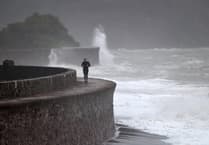
While a Yellow snow and ice weather warning for the South Hams is due to expire at 11am on Tuesday 6 January, the Met Office has said there is a risk of further weather warnings heading towards the end of the week.
There are signs that strong winds and heavy rain, as well as further snow accumulations, may bring additional hazards to the impactful weather across the UK. There is some uncertainty over the position of a low pressure system which is important in understanding the potential weather hazards it may bring.
Deputy Chief Meteorologist, Mike Silverstone, explains: “While we’re confident an area of low pressure will move in from the west on Thursday and into Friday, the exact position of that low pressure is uncertain at this stage. The position is important as it will determine the type of severe weather different locations may experience.
“The most likely scenario at this stage is for low pressure to track near the south coast. Near and south of the low, heavy rain and strong winds are more likely, whilst snow could accumulate to the north as it encounters cold air. As confidence increases in the track of the low pressure, so will the detail of the weather impacts so it is important to stay up to date with the weather forecast through the week.”
With temperatures are expected to drop to -3°C, the Met Office’s WeatherReady campaign offers practical advice to help you prepare your home, garden, and daily routines for winter weather.


Comments
This article has no comments yet. Be the first to leave a comment.